
Stories
El Nino Reaches Record High as Japan Weather Agency Warns of Winter Impact

- •Japan Meteorological Agency reported El Nino reached its strongest intensity on record in September, with sea surface temperatures 4 degrees Celsius above normal.
- •The previous record of 3.6 degrees Celsius set in December 1997 was surpassed, marking the highest level since record-keeping began in 1949.
- •El Nino conditions have persisted in the equatorial Pacific since spring 2026 and are expected to continue through the Northern Hemisphere winter.
- •The natural climate pattern alters global wind patterns, atmospheric pressure, and rainfall, increasing the risk of droughts and floods.
- •Major El Nino events release heat into the atmosphere, often contributing to elevated global average temperatures in the following year.
Key Questions Answered
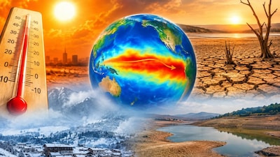
Japan's Meteorological Agency reported that El Nino reached its strongest intensity on record, with sea surface temperatures in the central and eastern equatorial Pacific Ocean hitting 4 degrees Celsius above normal in September. This surpassed the previous record of 3.6 degrees Celsius set in December 1997, marking the highest level since records started in 1949.
The Japan Meteorological Agency warned that the powerful weather pattern is expected to continue through the Northern Hemisphere's winter. Furthermore, WMO forecasts indicate a near-100% likelihood that El Nino will persist through February 2027, potentially becoming one of the strongest events since at least 1950.
El Nino causes surface temperatures in parts of the tropical Pacific Ocean to rise, which alters wind patterns, atmospheric pressure, and rainfall worldwide. These changes increase the risk of extreme weather events such as droughts and floods, and the released ocean heat often contributes to higher global average temperatures in the following year.