

Stories
Karnataka Harnesses AI and Satellites to Monitor Crops in Drought-Hit Areas
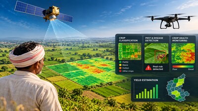
- •Karnataka plans to introduce satellite-based crop monitoring and yield estimation to improve agricultural planning and crop-loss assessment in drought-hit regions.
- •The pilot project will be launched under the CM Raitha Chaitanya Karnataka Agritech Mission 2026, covering two crop seasons across selected taluks in Belagavi, Vijayapura, Raichur, and Koppal districts.
- •The proposed system integrates satellite imagery, drone data, GIS, weather information, and field observations to classify crops and monitor health.
- •Artificial intelligence and machine learning models will be used to identify potential pest and disease outbreaks and assess crop health every fortnight.
- •The project aims to develop validated models to estimate crop yields at the village level, with potential for statewide expansion based on the pilot's performance.
Key Questions Answered
Under the CM Raitha Chaitanya Karnataka Agritech Mission 2026, the state will integrate satellite imagery, drone data, GIS, weather info, and field observations. AI and machine learning models will classify crops, detect pest outbreaks, and generate bi-weekly crop-health maps and statistics across selected pilot areas.
The pilot covers two crop seasons across two study areas of around 500 sq km each. The first area includes Athani taluk in Belagavi and Tikota in Vijayapura, while the second area includes Devadurga and Sindhanur in Raichur, and Kustagi in Koppal.
The state government has classified 226 out of Karnataka's 240 taluks as drought-hit. Total crop losses resulting from these severe drought conditions have been estimated at more than Rs 46,324 crore.